Joseph Parker
LIS 530
3/7/2026
Data Nesting
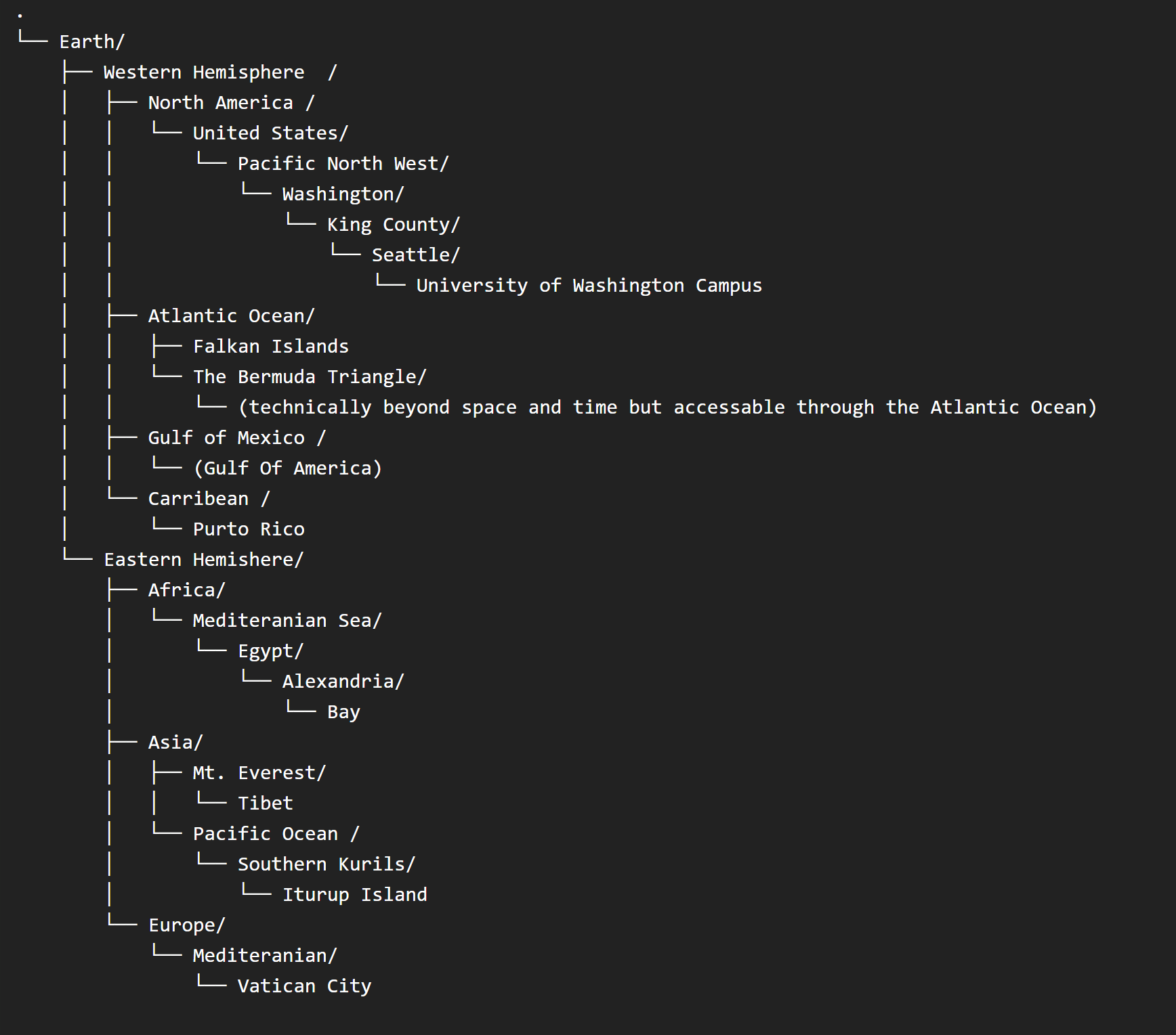
This assignment clearly illuminated just how much power and politics relate to geography and how much our work in description, cataloging, and organization can reinforce or challenge these claims. When doing the hierarchy nesting I wanted to have all of the terms connected to each other at least one point, almost like a taxonomic chart. To do this I decided to start with earth, split it into eastern and western hemispheres and tried to connect each to at least one geographic landmark/feature. I chose hemispheres because I thought it related well to that idea of spheres of influence with the Gulf of Mexico and Puerto Rico both being prime examples of the ways that empires exert and maintain power. With locations like the Gulf of Mexico the name not only directly ties it to a place but in changing it to the Gulf of America that signals the power of the United States with multiple massively powerful mapping software companies within its borders to make these charged moves. Looking at the Hughes reading and its mention of the renaming of Dersim and the later military intervention it is hard not to draw similarities between that and the United States actions in Venezuela so soon after renaming the Gulf as a way of asserting(or reasserting) a sphere of influence over Central and South America [1] . There is also the idea that renaming it as the Gulf of America on the one hand seems innocuous, justified as an appropriate renaming with America being a term that could apply to North, Central, or South but then we have to think Amerigo Vespucci whom the name comes from and the fact that the label of America does reinforce the idea that this land (and water) had no history before Europeans arrived. I chose to use Gulf of Mexico and then attach a parenthetical label to Gulf of America, honestly because it was what I was used to. All of the historical and ethical dimensions aside, I did default to the option that I grew up with, kind of proving how powerful a "default" name can be.
On the other side, leaving a name out is a function of power. The fact that Tibet isn’t even a visible location mark on Google maps is a clear indication that, as is mentioned in the Pavlovskaya piece, powerful nations with powerful tech/mapping connections can effectively “enhance and reconfigure their power” through maps[2]. I had to check multiple maps and confirm that this area was what I thought it was because it is obscured through the lack of information linking to the idea above that the ability to overwrite a name is an act of power so too is the ability to decide that a place does not deserve one. These points clearly illustrated the political nature of maps and illustrated why it is so important to examine what names, by whom are they used, and which ones get prioritized.
[1] Sandberg, Chapter 6 “Cataloging Kurdistan: Imagining Liberated Geographies
[2] Pavlovskaya “Critical GIS as a tool for social transformation”